Imagine a new person has come to your mine site. Giving them a few sheets of one line descriptions of hazards will mean nothing to them. It MAY meet the requirements of acts and regulations, however, with modern technology we can do so much more. Your hazard identification system should be more advanced than a simple excel sheet that anyone can access and edit or a printed out report on a bulletin board somewhere.
Giving your workers a visual hazard map with georeferenced hazard locations and recent site imagery will let them know exactly what to expect. Add in the details of the hazard and they will be equipped to complete their work safely. It is even better if you make the map interactive and accessible offline.
That’s exactly what we’ve done at HazView and it works on any modern device (phone, tablet, PC).
Interactive hazard map requirements:
If you’re looking at introducing visual hazard management into your site, you should have the following:
- Recent imagery.
- Hazard locations (markers and areas).
- Hazard details.
- Hazard controls.
- Ability to toggle layers on and off.
- Ability to export data to another service.
- Your device location.
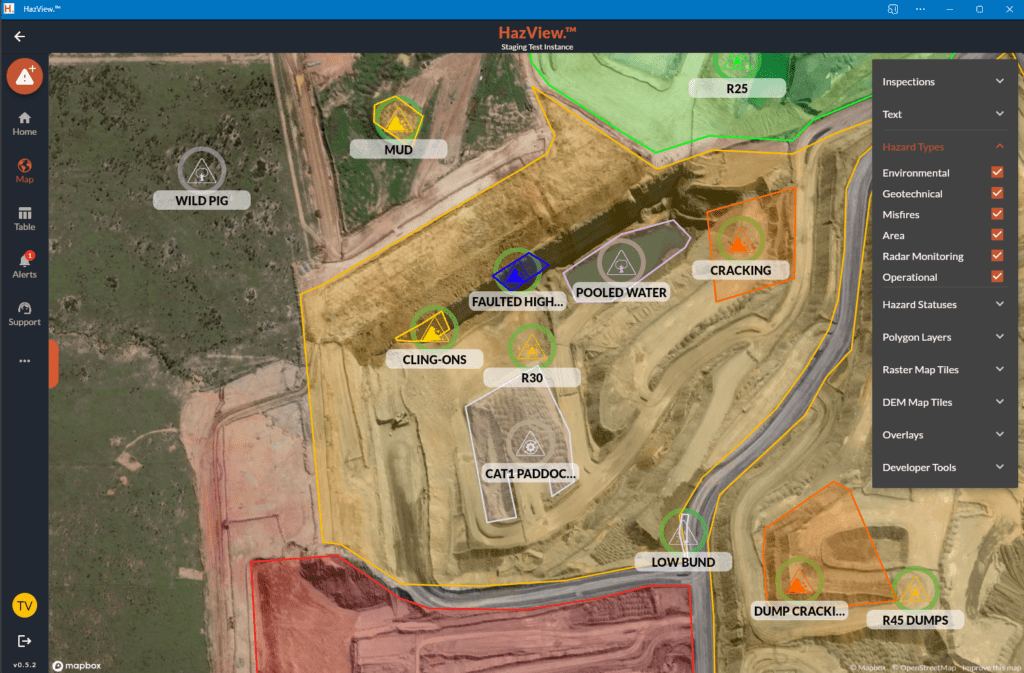
Below is a screenshot directly from HazView. You can see all the hazards in your area. You also get simple control over what is and isn’t shown.
Imagine if your site had touch screens with a live hazard map in the crib huts.
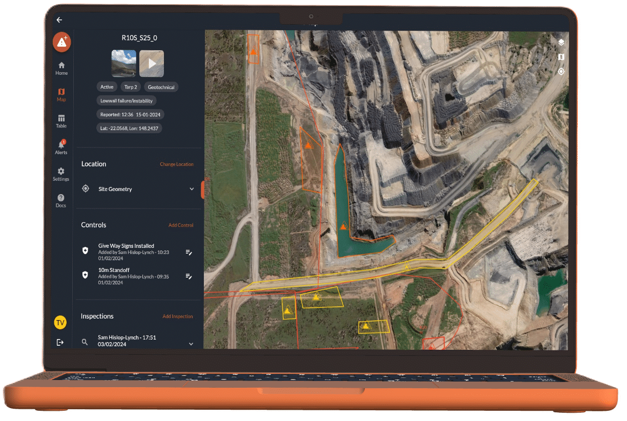
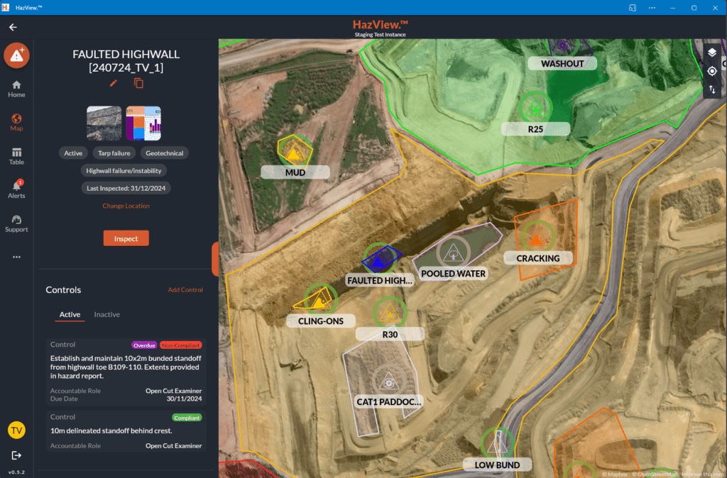
How to you know your work area is safe?
If a worker is new to an area, it can be daunting trying to understand all the hazards around them and the required controls while focusing on getting their job done. With an interactive hazard map, this becomes a simple task! You can see your location and the hazards around you. By clicking on one of them, you can see all the latest details, photos, documents and required controls. A real example is provided in the image below. A map like this is far more useful than a printed out crumpled table of one-lined hazard descriptions.
What is required to set up HazView?
HazView can be set up at any open cut mine site. We collect your current hazard data and import it into the software. We then sit down and discuss:
- Desired hazard properties.
- TARP / Severity rating system.
- Site imagery processes and integration.
- User roles (OCE, supervisor, manager, SSE, geotechnical, mine planning e.g.).
It is then a turn-key solution. We can create accounts for all your users. You then have a single source of truth for all hazards that can be updated and used to generate shift-based reports, as well as customised paginated reports (typical examples are one page per hazard print outs).