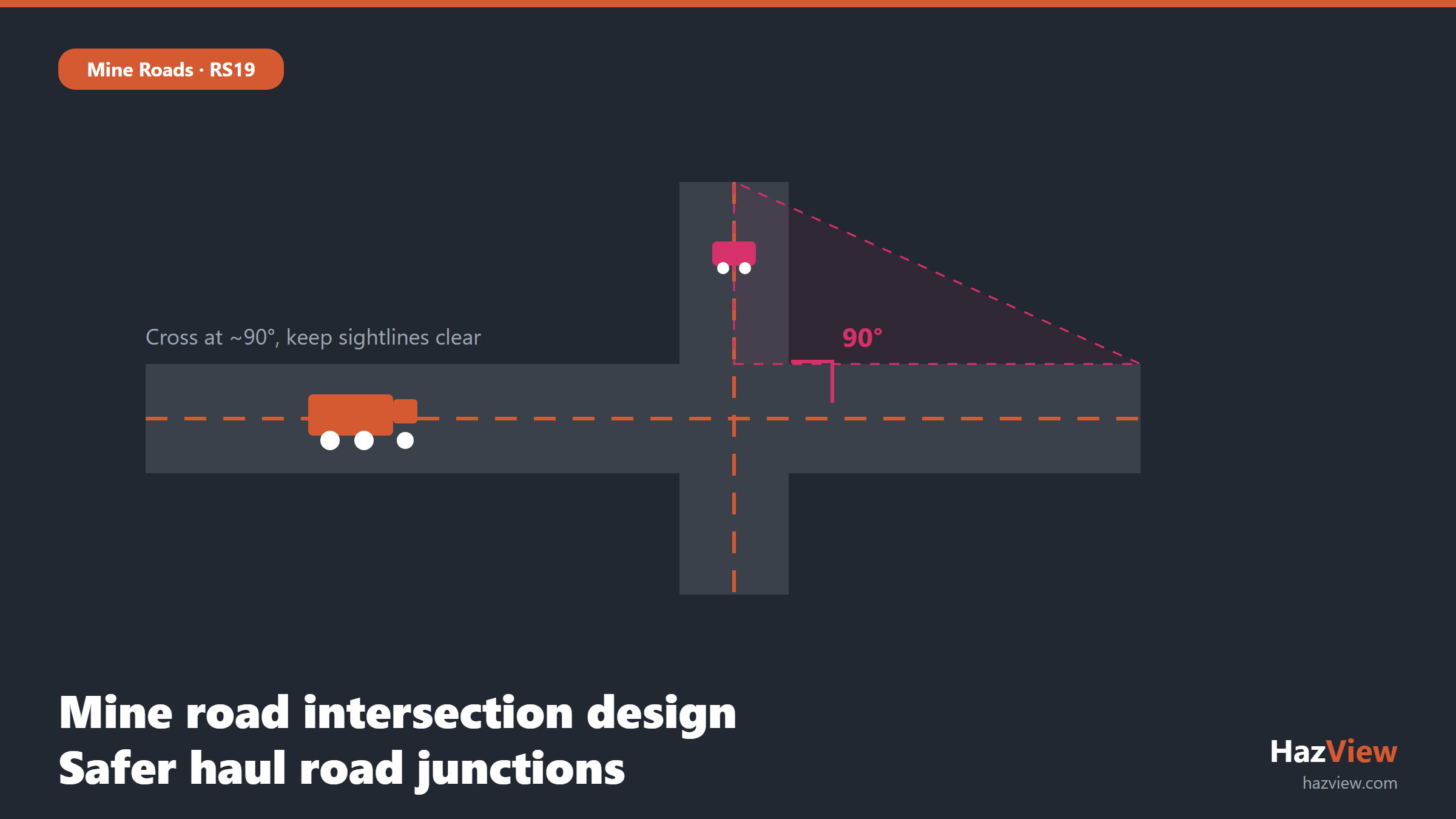
Good mine road intersection design is about geometry that lets an operator see, decide and stop before a collision becomes possible. Under Queensland’s Recognised Standard 19 (RS19), the safest haul road junctions are simple: roads that meet at about 90 degrees, clear sightlines in every direction, controlled priority, and no confusing multi-leg layouts. This guide walks through what RS19 expects at intersections, why those rules exist, and how to build the checks into your day-to-day hazard management so non-compliant layouts get flagged before a light vehicle and a 200 tonne truck arrive at the same point.
Why intersections are a killer on mine roads
Intersections concentrate risk. They are the one place on a haul road network where vehicles on different paths are meant to cross, and where a light vehicle in the blind spot of a haul truck can be invisible to the operator until it is too late. Vehicle interaction is a declared principal hazard at Queensland surface coal mines, so it must be managed through a principal hazard management plan rather than treated as a routine risk. You can read more in our overview of the vehicle interaction principal hazard.
The physics are unforgiving. A loaded rear-dump truck needs a long stopping distance, has enormous blind zones, and cannot swerve. When an intersection forces the operator to judge a shallow-angle merge or crane around the cab, the design has already loaded the dice. The RS19 approach removes those judgement calls by fixing the geometry so the safe action is the obvious one.
What RS19 says about intersections
RS19, “Design and Construction of Mine Roads”, is a Queensland recognised standard issued under section 72 of the Coal Mining Safety and Health Act 1999. The current published edition is the 2019 version of RS19, and it sits alongside the Coal Mining Safety and Health Regulation 2017 as the reference the regulator expects you to have considered. It is a statement of good practice: if you depart from it, you need a documented reason and an equivalent or better control. For the full picture, see our RS19 design and construction of mine roads guide.
On intersections, the core principles are consistent and practical:
- Cross at about 90 degrees. RS19 recommends roads meet as close to a right angle as the terrain allows, typically within roughly plus or minus 5 degrees of 90. A square intersection gives the operator the shortest, clearest head-turn to check both approaches and removes the long blind quarter that a shallow angle creates.
- Avoid Y-shaped and multi-leg intersections. Acute-angle merges and junctions with more than four legs multiply the number of conflict points and force operators to judge closing speeds at an angle. RS19 favours simple T and cross layouts over Y and star arrangements.
- Keep the grade flat through the junction. Intersections should be built on flat ground, not on a grade, so vehicles can stop and hold without rolling and loaded trucks are not fighting a hill as they enter the conflict zone.
- Provide flat zones at ramps. Where a ramp meets a bench road or another route, RS19 recommends a flat landing, typically in the order of 25 metres, at both the base and the top of the ramp before the intersection, so vehicles are on level ground when they arrive at the decision point.
None of these are arbitrary. Each one shortens the time an operator needs to perceive a hazard and lengthens the distance available to react. Combine a square crossing, a flat approach and a clear view, and you have designed most of the risk out before a single sign goes up.
Sightlines and stop control
Geometry only helps if the operator can actually see. Sight distance is the length of clear road an operator can view ahead, and at an intersection it needs to be long enough for the largest, heaviest vehicle on that road to come to a controlled stop from its normal operating speed. That means measuring against the worst case, a fully loaded haul truck at speed, not a light vehicle.
Common things that quietly eat into sightlines include stockpiles and windrows near the junction, high median berms, parked equipment, spoil, signage clusters, and the crest of a nearby rise. The sight triangle, the area an approaching operator must be able to see across to detect a vehicle on the crossing road, has to stay clear of all of them. Design the intersection so that priority and stopping requirements are unambiguous:
- Assign clear priority. One road gives way, and the give-way road is signed and, where warranted, physically controlled with a stop position.
- Set the stop or give-way line where the operator on the minor road can see the full length of required sight distance along the major road.
- Check sightlines from the correct eye height. A haul truck cab sits metres above a light vehicle, so a berm that blocks a ute driver’s view may be irrelevant to a truck operator and vice versa. Design for both.
- Re-check sightlines as the pit develops. A clear intersection today can be blinded next month by a new dump or a growing stockpile.
Median and centre berms
A median berm is a raised earth bund running down the centre of a road to separate opposing traffic, and at an intersection it helps channel vehicles onto the correct path and discourage corner-cutting. The design tension is obvious: a berm tall enough to guide a truck can also be tall enough to hide an approaching light vehicle. RS19 resolves this by favouring low berms at intersections, high enough to channel and delineate the path but low enough that they do not block the sight triangle. In short, the median should guide the wheels without hiding the traffic.
Practical points for medians and centre berms at intersections:
- Keep the berm profile low through the sight triangle so operators can see across it from both cabs.
- Use the median to define the turning path and prevent short-cutting the corner, not as a visual barrier.
- Maintain the berm. Erosion, spillage and repeated grading change its height and shape over time, and a well-designed berm can drift out of compliance.
- Do not confuse a median berm with the perimeter windrow or safety berm that stops a vehicle running off the edge. They do different jobs and are sized differently.
For how edge protection is sized around the rest of the network, see our companion guide to mine road safety berms.
Signage, lighting and delineation
Once the geometry is right, signage and delineation tell operators what to do at speed and in the dark. Every intersection should be announced with advance warning, controlled with clear priority signs, and made visible at night. The aim is that an operator arriving for the first time, at night, in dust, can read the intersection without hesitation.
- Advance warning signs sited far enough back that a loaded truck can respond before the junction.
- Consistent give-way and stop signage that matches the priority set in the design, used the same way across the whole site.
- Reflective delineators, guide posts or edge markers so the road alignment and the median are visible in headlights.
- Lighting or high-visibility marking at busy or complex junctions where light vehicles and haul trucks mix.
- Speed control on the approach where sight distance is constrained and cannot be improved.
Signage is the last line, not the first. It supports good geometry, but it cannot rescue a Y-shaped junction with blind approaches. Fix the layout, then sign it.
Designing intersections into your hazard map
The hard part is not knowing the rules, it is keeping every live intersection compliant as the pit changes week to week. This is where a spatial view earns its keep. In HazView for OCEs, each intersection can be dropped onto an interactive hazard map over current imagery, with its geometry, priority control, sightline notes and inspection history attached to the point. When a new dump grows into a sight triangle or a berm is graded down, the layout that has drifted out of compliance is visible on the map rather than buried in a folder, and the relevant checklist can be raised against it.
Intersection compliance checklist
Use this as a starting point for inspecting or designing a haul road junction against RS19, adapted to your site’s standards and vehicles.
- Roads meet at about 90 degrees, within roughly plus or minus 5 degrees.
- Layout is a simple T or cross, not a Y or a multi-leg junction.
- The junction sits on flat ground, not on a grade.
- Flat zones of around 25 metres are provided at the base and top of any adjoining ramp.
- Sight distance meets or exceeds the stopping distance of the largest loaded vehicle at its operating speed.
- The sight triangle is clear of stockpiles, spoil, parked plant and signage clutter.
- Priority is assigned and signed, with a defined stop or give-way position.
- Median and centre berms are low enough not to block the sight triangle.
- Advance warning, priority signage and night-time delineation are in place and consistent.
- The intersection is recorded on the hazard map and re-inspected as the pit develops.
Resources Safety and Health Queensland publishes current standards and safety alerts at rshq.qld.gov.au.
Related guides
- Mine Road Safety Berms: RS19 Height and Placement Requirements
- Haul Road Grades and Ramps: RS19 Design Limits Explained
- What Is a TARP? Building a Trigger Action Response Plan for Mine Roads
- All Mine Roads & RS19 guides
Frequently Asked Questions
What angle must mine road intersections meet at?
RS19 recommends that mine roads meet as close to 90 degrees as the terrain allows, typically within about plus or minus 5 degrees. A square, right-angle crossing gives operators the shortest and clearest view of both approaches and removes the long blind quarter created by a shallow-angle merge. It is a recommendation of good practice rather than a fixed legal number, so a documented reason and equivalent control is expected wherever the site departs from it.
Why avoid Y intersections?
Y-shaped intersections force vehicles to merge at an acute angle, which creates a large blind spot on the trailing side of the cab and makes it hard for an operator to judge the closing speed of crossing traffic. They also add conflict points compared with a simple T or cross. RS19 favours square junctions precisely because they shorten the operator’s head-turn and make priority and sightlines easier to design and read.
What is a median berm?
A median berm, sometimes called a centre berm, is a raised earth bund running along the centre of a road to separate opposing traffic and to channel vehicles onto the correct path through a junction. At intersections it should be kept low enough that it does not block the sight triangle, so it guides the wheels without hiding an approaching vehicle. It is different from a perimeter safety berm or windrow, which is edge protection sized to stop a vehicle running off the road.
How far should the flat zone extend from a ramp?
RS19 recommends a flat landing, typically in the order of 25 metres, at both the base and the top of a ramp before it meets an intersection. The flat zone means vehicles are on level ground when they reach the decision point, so a loaded truck is not accelerating downhill into the junction or fighting a grade to hold position. Confirm the exact distance against your site’s road design standard and the vehicles in use.
Ready to see your intersections and haul road hazards on one live map, with RS19 checks built into your inspections? Book a HazView demo and we will show you how it works on your own site imagery.